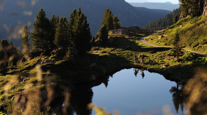
Val di Fiemme is a very vast territory that offers infinite possibilities for excursions of different levels and walks suitable for everyone. For mountain lovers there is embarrassment of choice between walks and hikes in the woods, mountain routes and mountaineering routes through the peaks of the most important and evocative of the Dolomites.
Furthermore, with the Guest E-Motion Card of the Fiemme Valley you can take advantage of a rich program of activities and public transport in the Trentino region.
We suggest you some of the most beautiful itineraries to try…
THE LAKES OF BOMBASEL (LAGORAI MOUNTAIN CHAIN)
DIFFICULTY: Easy
TOTAL TIME: 2 hours
DEPARTURE: From the top of Paion del Cermis (2,229 m)
Reachable by cable car from Cavalese.
NOTES: Simple hike at high altitude with a panoramic view of the Lagorai mountain chain.
Ideal for families, the Bombasel lakes shine like crystal mirrors reflecting the sun and the surrounding nature.
THE LABYRINTH OF LATEMAR
DIFFICULTY: Medium – Easy
TOTAL TIME: 3-4 hours
DEPARTURE: Lake Carezza car park (1,520 m)
NOTES: Going along the Carezza lake you take the path that leads first to the Mitterleger and reaching further
on to the Labyrinth created by a landslide of the mountain.
THE THINKING CHRIST (PASSO ROLLE 1.984 m)
DIFFICULTY: Medium
TOTAL TIME: 2-3 hours
DEPARTURE: From Baita Segantini (2,170 m) reachable on foot from Passo Rolle in 40 min.
NOTES: In the direction of Monte Castellazzo, go along a comfortable path with a view of the Pale di San Martino,
Val Venegia and Marmolada. Then go up to the top where the statue of the Thinking Christ is located.
VAL VENEGIA
DIFFICULTY: Easy
TOTAL TIME: 1.5 hours to Malga Venegiota
DIFFICULTY: Medium
TOTAL TIME: 3 hours to Baita Segantini
DEPARTURE: From the entrance of Val Venegia (1,800 m) on the road leading to Passo Valles.
NOTES: From here, walk on the forest road towards Malga Venegia and Malga Venegiota. You can continue
the signs for the Baita Segantini. The route winds through an enchanting landscape, under the
imposing Pale di San Martino. Return on the same route.
CECE PEAK
DIFFICULTY: Medium / Difficult (for hikers)
TOTAL TIME: 7-8 hours
HEIGHT DIFFERENCE: 1,180 m
DEPARTURE: From the bridge just before the Val Maggiore, Predazzo (1,570m)
NOTES: Take path 336 which leads to Lake Cece (1,879 m). From here continue on the same path that leads
first to the Caserina Lake (2,087 m) and then continue to Forcella di Cece (2,393 m).
Then take path 349, after an hour’s walk there is a detour on the left that leads
to the top of Cima Cece (2,754 m). Always on the path 349 you go down to the Forcella di Val Maggiore
walking on the remains of a paved road that leads to the Bivouac Paolo and Nicola, the return takes place on the path 335.
CORNON
DIFFICULTY: Easy
TOTAL TIME: 4-5 hours
HEIGHT DIFFERENCE: 320 m
DEPARTURE: From the departure of the Pampeago lifts or continue to the Tresca chairlift.
NOTES: Take the dirt road 514 towards Baita Caserina, continue towards Baito la Bassa.
Continue on path 523 to Baito Armentagiola. From here you can extend the walk on path 518
to the top of Cornacci (2,189 m) where you can enjoy a wide panorama over the Fiemme Valley.
Return to the same path.
Links


